The Pinzgauer Spaziergang Trail
A high-level hike at its best
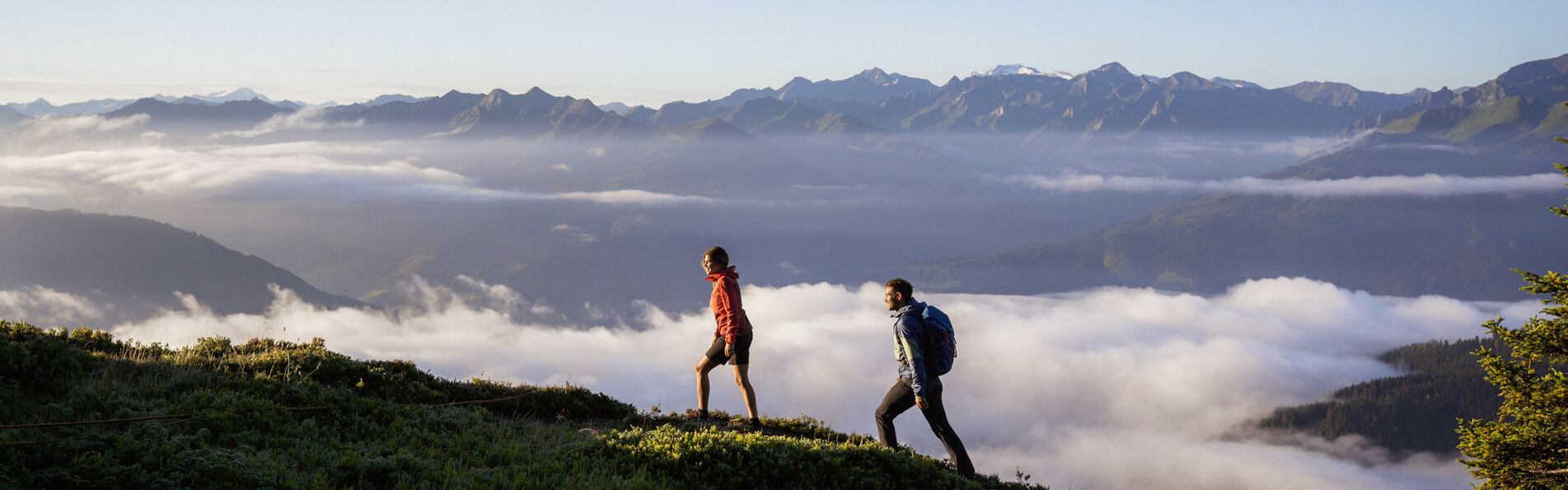
The Pinzgauer Spaziergang Trail is a real gem among long-distance hikes. Discover this trail on the Schmitten, one of the most beautiful high-altitude hikes of the Eastern Alps.
A high-altitude hike through the Eastern Alps
Großglockner, Kitzsteinhorn, Granatspitze, Sonnblick, Großvenediger … Let the impressive summit panorama of the Hohe Tauern range impress you! Throughout the entire hike, you’ll have an amazing view of the Salzachtal valley located 1,000 metres below. Get excited about this extensive walk through the Pinzgauer Grasberge – a true highlight when the weather is nice.
Details about the long-distance hike in the Pinzgau
Ready for a day trip into the mountains? Take a look at the most important information about the Pinzgauer Spaziergang – all details at a glance:
- Difficulty: medium (requires endurance!)
- Length: about 17 km
- Duration: about 6 hours
- Elevation gain/loss: 746 m during the ascent and 728 m during the descent
- Highest point: 2,081 m
- Start: Schmittenhöhe
- Destination: Schattberg in Saalbach
- Route: Kettingtörl – Pinzgauer Hut – Kettingkopf – Kesselscharte – Rohrertörl – Klammscharte – Klingertörl – Seetörl – Hacklberger lakes – Schattberg
- Tips: sturdy footwear; sufficient snacks and water (open huts and restaurants along the way can only be reached via slight deviation from the Pinzgauer Spaziergang trail); park at the Schmittenhöhebahn or trassXpress; bus connections from Saalbach to Zell am See; descent with the Schattberg X-press with a valid ascent and descent ticket; the hike is possible starting in Saalbach as well

A long-distance trail highlight in the Pinzgau
17 kilometres in about six hours at up to 2,081 metres above sea level. One thing’s for sure: Even if this long-distance hike is called “Spaziergang” (“walk”), it’s definitely not a walk in the park. Endurance, sturdy footwear and a certain level of surefootedness are required. If these prerequisites are fulfilled, the Trail is a great option for an extensive family hike as well.
The route of the Pinzgauer Spaziergang
The hike starts on the Schmittenhöhe and continues south-west towards the Kettingtörl. Follow the trail to Pinzgauer Hut, across the Kettingkopf to Kesselscharte. Passing the Maurerkogel in the north and Hochsonnbergalm in the south, the trail continues to the Rohrertörl and further west to Klammscharte. If you keep walking across the Klinglertörl and the Seetörl and along the Hacklberger lakes, you’ll eventually reach the end of the Pinzgauer Spaziergang at the Schattberg in Saalbach.
Keep in mind: Open huts and restaurants along the way can only be reached via slight deviation from the Pinzgauer Spaziergang trail! Bring sufficient supplies – ideally two complete meals, additional snacks and several litres of water.
How to get to the Schmittenhöhe
From 9:00 am on, the Schmittenhöhebahn or trassXpress takes you up to the start of the long-distance hike. You may park directly at the valley station (Schmittenstraße 119, 5700 Zell am See). After the hike, the Schattberg X-press in Saalbach takes you back down to the valley. From there, you can take the bus back to Zell am See.
Other hiking routes on the Schmitten
Six hours of walking time is too much for you? You’d prefer to stay on the Schmittenhöhe during your hike? No problem! Find out more about this and other hiking routes in Zell am See with our interactive map.
The Schmittenhöhebahn AG doesn’t assume liability for possible accidents and injuries!


